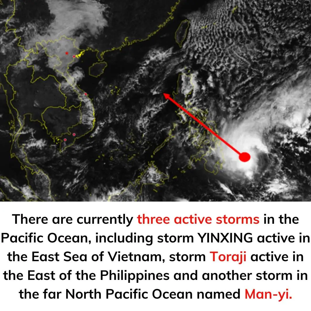
According to the National Center for Hydro-Meteorological Forecasting, at 4:00 a.m. on November 11, the center of storm No. 7 was at about 17.5 degrees North latitude; 111.8 degrees East longitude, in the sea area north of Hoang Sa archipelago. The strongest wind near the center of the storm was level 8, gusting to level 10. Moving southwest, speed about 15 km/h.
At 4:00 a.m. on November 12, the center of the storm was at about 14.9 degrees North latitude; 109.6 degrees East longitude, in the sea area of Quang Ngai-Binh Dinh. The strongest wind near the center of the storm was level 6, gusting to level 8. Moving southwest, speed about 15 km/h, weakening into a tropical depression and continuing to move in the Gia Lai-Binh Dinh area.
The western sea area of the North East Sea (including the Hoang Sa archipelago) has strong winds of level 6-7, near the storm's eye level 8, gusts of level 10, waves 2-4 m high, near the storm's eye 3-5 m; rough seas.
From the afternoon of November 11, the sea area off the coast of Thua Thien-Hue to Binh Dinh has winds gradually increasing to level 6-7, gusts of level 9, waves 2-4 m high; rough seas.
Vessels operating in the above-mentioned dangerous areas are likely to be affected by thunderstorms, whirlwinds, strong winds, and big waves.
Three consecutive storms
Mr. Nguyen Van Huong, Head of the Weather Forecast Department, National Center for Hydro-Meteorological Forecasting, said that the East Sea will welcome three consecutive storms.
The first is storm No. 7 (international name Yinxing). Storm No. 7 is active in the East Sea area of Vietnam. Another storm, Toraji, is active in the eastern part of the Philippines, and another one is off the coast of the Northwest Pacific Ocean, named Man-yi. In addition, there is another tropical depression between Toraji and Man-yi.
00:00 / 00:00
Mr. Nguyen Van Huong provides information about active storms. VIDEO: Hoang Linh
According to Mr. Huong, these three storms and tropical depressions are all located on a tropical convergence zone whose axis passes through the North East Sea. And tropical depressions or storms that form on a tropical convergence zone often move in the direction of the tropical convergence zone axis.
According to Mr. Huong, this explains why in the near future, the East Sea will continuously receive tropical cyclones. First is storm number 7, after about 24-48 hours it could be storm number 8 and it is also possible that storm number 9 may appear in the near future. With such continuous storms, dangerous weather conditions at sea will continue to persist.
Regarding storm number 7, Mr. Nguyen Van Huong said the most dangerous impact is strong winds at sea. Ships operating in dangerous areas are likely to be affected by thunderstorms, tornadoes, strong winds, and large waves.
Due to the influence of storm number 7's circulation, from the evening and night of November 11 to the end of November 12, there will be rain in the Central and South Central regions. From early morning of November 12 to November 13, in the area from Thua Thien Hue to Binh Dinh, there is a possibility of moderate to heavy rain, locally very heavy rain with common rainfall of 70-150mm, locally over 250mm. From the night of November 13, heavy rain gradually decreased.
People in the coastal areas of the Central region, especially from Quang Tri to Quang Ngai, need to closely monitor the storm situation and prepare response plans to minimize risks.